Latest data brings risk maps up to date
The maps take into account the latest data on wildfire ignition across the Peak District.
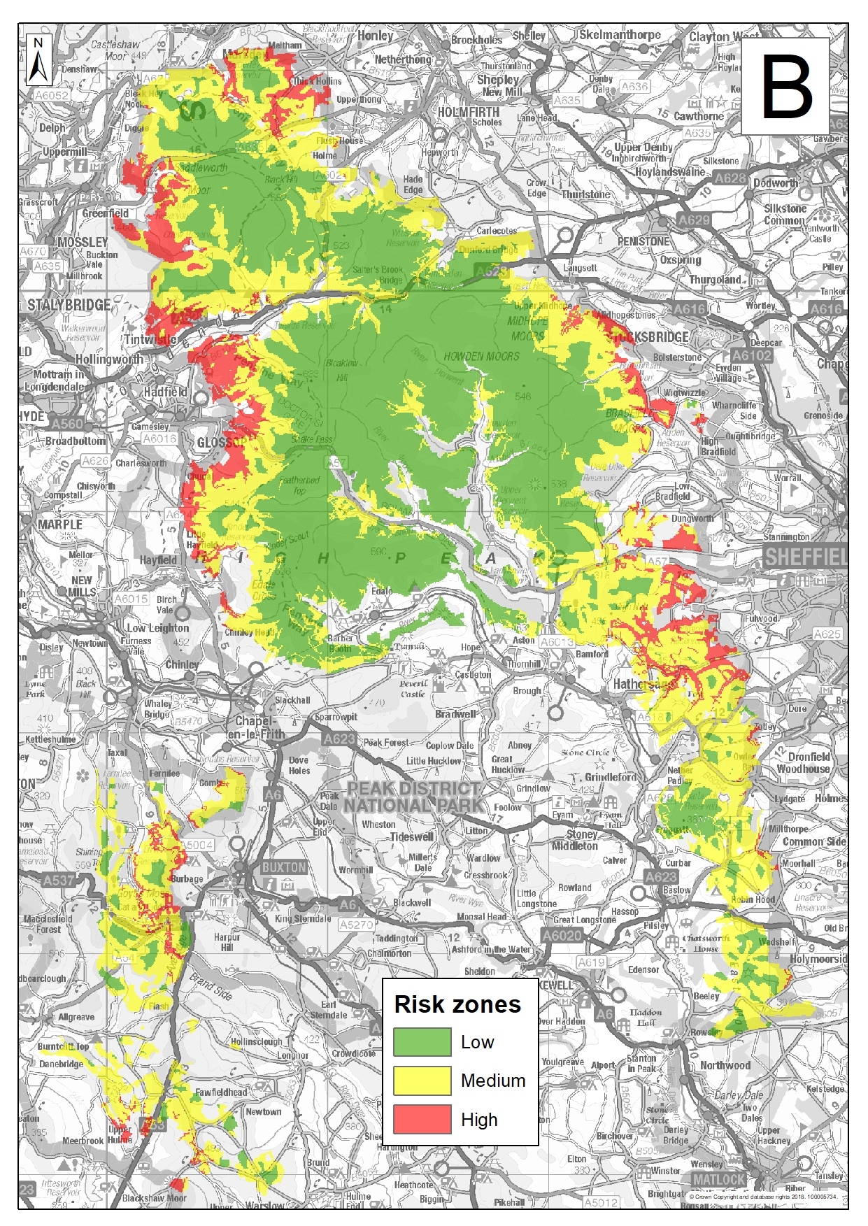
The maps have been produced using data from Moors for the Future Partnership's newly updated wildfire database, which aims to collect comprehensive information about moorland wildfires across the Peak District and South Pennine moors.
The maps show that over time, the places where wildfires started has changed. Fires are now more likely to start on the fringes of moorland, whereas in the past they were more likely to start on high moorland areas. Higher fire risk areas are in easily accessible places close to population centres.
The maps will be used by firefighting teams and FOG (Fire Operations Groups) groups. They will also be used to plan education and public engagement to prevent wildfires.
The work was funded by MoorLIFE 2020 and the Peak District FOG group.