The behaviour of water on the moors
We monitor how water behaves in order to see whether our work is affecting it. We want to find out whether any changes are beneficial and meet our objectives.
Why are we interested in water?
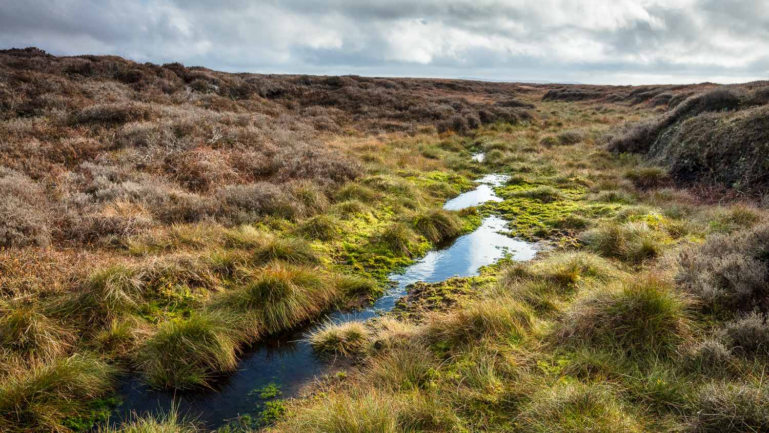
In a healthy state, many of moors in the Peak District and South Pennines would be much wetter than they are, with water stored in the peat to a level (known as the water table) that is at or very near the surface. A high water table is critical for blanket bog to become active (growing peat rather than losing it) and helps reduce fire risk, too.
A well vegetated moorland has a rough surface which slows the speed of water flowing over it and into watercourses. We measure how water behaves during and after high rainfall periods, and how quickly it leaves the moors, because this may affect the potential for flooding downstream.
When water flows quickly, it carries material with it, both over surfaces and within streams and gullies. In particular, it carries peat, which contains about 50% carbon, and heavy metals. Both pollute drinking water which requires expensive treatment before it reaches our homes.
Our science team is supported by a team of volunteers to ensure robust monitoring provides the information and evidence we need.
What do we measure?
By taking regular measurements of the water table we can monitor how it is affected by our work blocking gullies and re-vegetating bare peat, and whether the techniques would be suitable to carry out elsewhere.
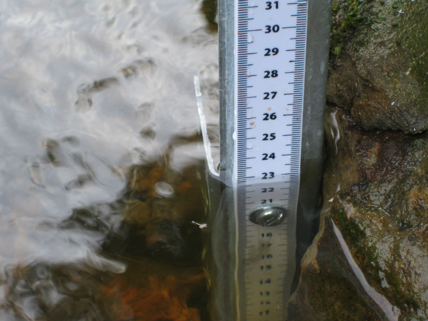
Onsite equipment measures water flow over the surface and in gullies, allowing us to compare flow with rainfall data. This enables us to understand ‘peak flow’ better and how it is related to flooding downstream. A better understanding of water on the moors will help us to take the best actions we can to reduce the risk of flooding.
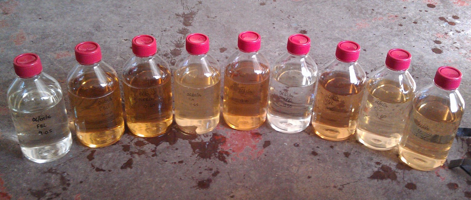
We take water samples to measure the levels of carbon and pollutants the water contains to see whether our work affects these levels. Carbon is lost from the moors in water as ‘particulate organic carbon’ (POC), which we can see as peat sediment, or as ‘dissolved organic carbon’ (DOC). DOC causes the brown colour of water in streams leaving the moors and is expensive to remove before the water is supplied to our homes. Healthy bogs prevent it from discolouring the water in the first place. Flows of water may also be more acidic than they would naturally be, and carry pollutants such as zinc, lead, copper and arsenic downstream into reservoirs and rivers.
Climate stations monitor the weather on site telling us about rainfall, temperature, and humidity. This is analysed in relation to other data and restoration activities.
How is work done?
Volunteers help our scientists manage monitoring sites across the moors to ensure the full suite of monitoring continues. Advanced technology means that many readings are taken and samples gathered automatically, but sites need regular attention. We need to regularly collect samples and download information collected by data loggers.
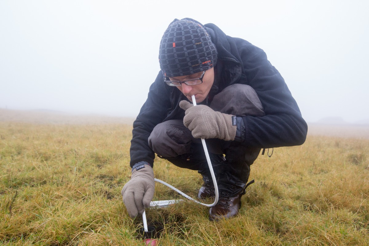
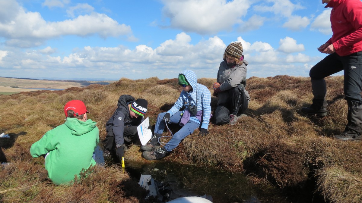
Every year we measure the depth of the water table in hundreds of locations. Known as our annual dipwell campaign, staff and volunteers take measurements to see how wet the moors are. Dipwells are small wells which are set up in clusters across the moors. They are checked manually by a team member who blows into a plastic tube as it is lowered into the well. When the tube reaches the water, bubbling is heard, and the resulting depth is recorded. This approach might seem low-tech but it has been proven to be the most reliable!
The measurements help us to identify if our conservation work is successful at raising the water levels, known as ‘water tables’ across the moors, which is an important factor for keeping them in a favourable condition.
Monitoring has shown...
Restoring bare peat slows overland flow of water and reduces flood peaks
In 2014, 100% of dams on Bleaklow were holding water and 82% were trapping peat sediment
Catchments on Kinder Scout became wetter following re-vegetation, with evidence of a higher water table
Did you know:
- there are high levels of heavy metals in peat in the Peak District and South Pennines because they were present in smoke from factories during the industrial revolution
- there are enough heavy metals (copper, lead, zinc) to mean that sediments in reservoirs are treated as toxic waste when dredged
- acidity is also high for similar reasons. Acid rain fell on the peat during this time turning it, in some cases, to the same pH as lemon juice. This decimated sphagnum moss populations and made the environment inhospitable for plants to grow
- dissolved organic carbon cannot be filtered out of water, so it has to be treated with chemicals to remove the brown colour
- any carbon finding its way out of peat and into watercourses is much more likely to end up as a greenhouse gas because it is exposed to natural chemical and biological processes